

iGeopix app for iPhone and iPad
Developer: CRS4
First release : 06 Aug 2010
App size: 1.22 Mb
GO TO: facebook.com/igeopix and twitter.com/igeopix
_______________________________
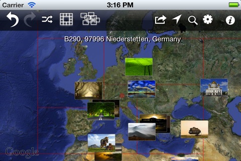
iGeoPix is an iPad/iPhone interactive visual browser for geolocated photos. Unlike the current georeferenced pictures representations used by Panoramio, Google map, Yahoo! map, etc., with iGeoPix you will be able to see both near and far photos, thanks to a non-linear zooming user interface.
The variable tile size, bigger in the center and smaller near the borders, will further contribute to give you the feeling of a more immersive visual browsing experience.
Imagine to browse the map and get the most relevant pictures with a magnifying glass through a tiled view composed of three concentric levels. The first level is filled with only one large tile containing an image considered the most representative around the maps center. The second level is composed by tiles laid around the first level like a crown, displaying the next 12 images relative to the map area around the first level. Consequently the third level, composed by 36 tiles positioned around the second level, corresponds to a more distant area from the center of the map.
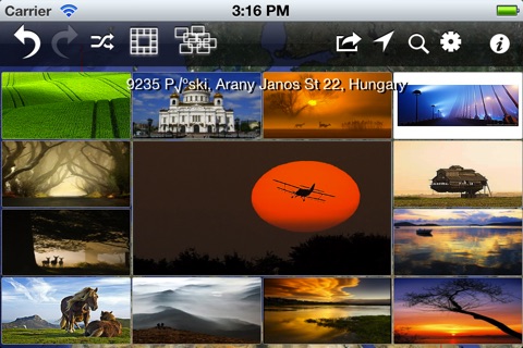
You can also view pix with the classic thumbnails mode (thumbs).
*** Search in google for "Youtube iGeopix" and play the resulting video "Flickr set iGeopix" and watch the 50+ snapshot photos.
With iGeopix you can:
* Visually browse the world by pictures in three modes: Map, Map & Pix, Pix Only, Thumbnails
* See the pictures in the classic thumbs mode: each thumbnail is positioned in its real geographical location
* Jump to your current location using internal GPS
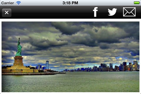
* Tap a picture to see it in full screen mode
* Select a picture and go to the relative web page
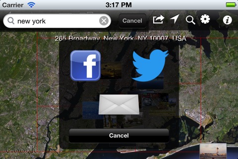
* Search a location by name or address
* Send postcards to your friends by email!
* Share postcards via FACEBOOK, TWITTER (new!)
* Browse all the postcards (places visited) back/forward (new!)
Panoramio is currently used as georeferenced image resource.
Only a tip: start in landscape select "Pix only" iGeopix mode and “By Pix” browse mode, enter a search string, then click on any image to recenter and renew the mosaic of geolocated photos. To zoom, double click to see medium resolution, then click on "HQ". Click on “View Details” to jump to panoramio page.
We designed and developed the so-called "fractal view" originally for web browsers. See GeoPix and GeoPix Fractal View. A technical description can be found on the published paper Fractal Browsing of Large Geo-Referenced Picture Sets (by Davide Carboni, Valentina Marotto, Francesco Massidda and Pietro Zanarini, Communications of SIWN, System and Information Sciences Notes, Vol 5 - August 2008).
iGeopix is an iPad/iPhone universal application, designed and produced by Information Society division (http://isoc.crs4.it) at CRS4 research center in Sardinia (Italy). (http://www.crs4.it)
For contacts: [email protected]